news

Be informed
Read the latest documents which tells you what kalteng consultants is doing.
- 2016 Marrakech Action Proclamation for our ...
- Peatland Restoration Agency, Republic of ...
- 2015 United Nations Climate Change Conference in ...
- Indonesia's Silent Tragedy in a Connected World ...
- Report by John Macdonald about the ongoing peat ...
- Indonesia's Fire Crisis — The Biggest ...
- Carbon emissions from Indonesia’s peat fires ...
- Get Your Facts Right on Indonesia's Haze
- Indonesia president visits forest fires amid smog ...
- Again El Nino year 2015: Hot Spots from Borneo ...
- El Nino year 2014: Hot Spots from Borneo taken on ...
- UNFCCC-Warsaw Conference - Framework for REDD+ ...
- Disappointing outcome for forests in Doha, but ...
- Governors Climate and Forests Rask Force, GCF, ...
- 2011 LIDAR- and RGB-Survey in Kalimantan ...
- UNFCCC Climate Summit in Cancún, Mexico, COP16; ...
- Reducing emissions from peatlands under REDD, WI ...
- Palangka Raya Declaration on REDD+ and MRV in ...
- Excursion to the burned Taruna-Base Camp in Block ...
- PRESS RELEASE. RAGING FOREST FIRES THREATEN WILD ...
- Milan Geoservice Calendar with Indoneisan ...
- An Investigation of LiDAR Data Processing in ...
- Successful Helicopter Flight Trials with Airborne ...
- Kalteng Consultants had an audience with the ...
- Declaration on the Heart of Borneo Initiative, ...
- 2006 Fires in Kalimantan, next El Nino Southern ...
- Suwido Limin, director of UNPAR/CIMTROP Fire ...
- The Amount of Carbon released from Peat and ...
- Kalteng Consultants Office, since
gallery

image gallery
Find a large collection of images from many years of exploration by kalteng-consultants.
news
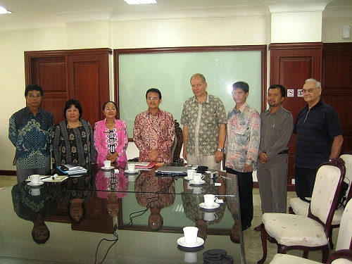
Kalteng Consultants had an audience with the Governeur Teras Narang from Central Kalimantan; 16.3.2007

Kalteng Consultants informed on 16. of March 2007 the governeur Teras Narang about the activities regarding the Airborne Laser Scanner Technology (ALS, LiDAR). This modern technology can help to improve the knowledge of Peatlands with precise data from the topography and hydrology in the Ex-Mega Rice Project (EMRP) and in other important areas in Central Kalimantan. The flight will take place in May 2007 depending of the weather condition and all permits.

