
projects

Our projects
Large areas of globally important tropical peatland in Southeast Asia are under threat from land clearance, degradation and fire jeopardising their natural functions as reservoirs of biodiversity, carbon stores and hydrological buffers. Local research capability will be strengthened enabling peatland managers to better understand and address the different, interrelated processes operating in tropical peatlands.
- Sambodja Lestari, BOS Foundation in ...
- LiDAR-Data and 30 RGB-Photos from Bukit ...
- RGB Photos from Block C and Sabangau catchment ...
- LiDAR survey 2011 in Central and East Kalimantan ...
- Three Ortho-Photo-Mosaiks taken with ...
- LiDAR and Ortho-Photo Survey in East- and Cenral ...
- LiDAR-Survey in Central Kalimantan for CKPP in ...
- EU - Project: RESTORPEAT-Project: Restoration of ...
- EU - Projekt: STRAPEAT-Seminar / Workshop on the ...
- EU Project - The STRAPEAT Project sponsored by ...
- EU Project: - Natural Resource Functions (Interim ...
- EU Project: - NATURAL RESOURCE FUNCTIONS, ...
- Mega Rice Project - The Benefits of Space-Based ...
- Mega Rice
gallery

image gallery
Find a large collection of images from many years of exploration by kalteng-consultants.
History Borneo - Kalimantan · Excursions to peatland 1996 · Mega Rice Project 1999 · 2004 · 2005 · 2006 · 2007 · 2008 · 2009 · 2010 · 2011 · 2012 · 2013 · 2014 · 2015 · 2016-March · 2016-August ·
projects
LiDAR-Data and 30 RGB-Photos from Bukit Bangkirai, Kaltim, for Uni Hiroschima
We processed LiDAR- Data and RGB-Photos from Bukit Bangkirai area in East-Kalimantan for Prof. Toshinori Okuda the University of Hiroschima.
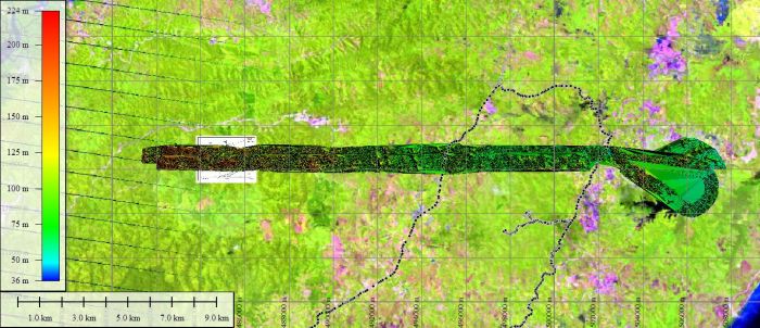
LiDAR Survey of Bukit Bangkirai area with two flight line with 3030ha, superimposed on Landsat 2009 in SW-GlobalMapper. Both helicopter flight trials are together approx. 1100m wide and the track is located at Bukit Suharto north of Balikpapan.
LiDAR-DTM-survey 29.7.2011 of Bukit Bangkirai area, East Kalimantan, with RGB-Photo superimposed on Landsat image 1992 with a 500m grid.
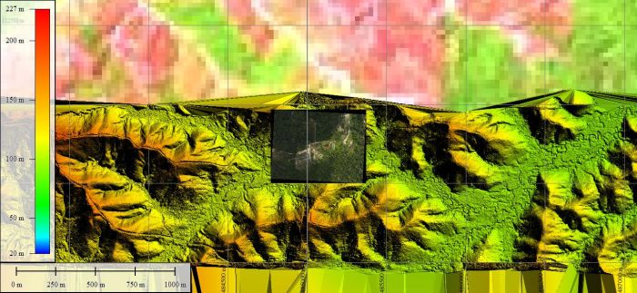
LiDAR DSM from Bukit Bangkirai area with forest, houses, bushes, roads, lake and tennis court. A profile of the DSM is seen in the left upper corner.
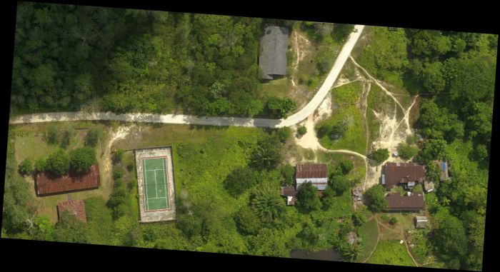
Ortho-Photo of Bukit Bangkirai area with details
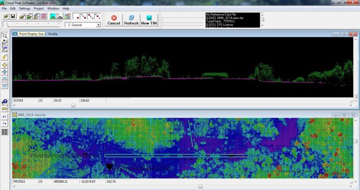
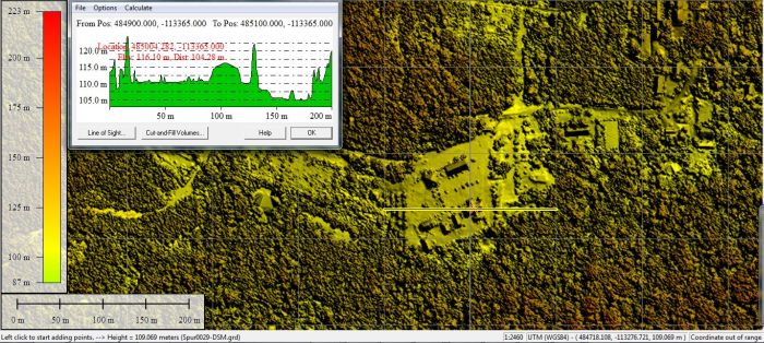
LiDAR-DSM in LAS-Presentation. The double line in the lower figure is shown as profile above.
