
lidar technologies

Lidar technologies
We measure distances by illuminating a target with a laser and analyze the reflected light.
- Biomass Situation of Mawas Region in Central ...
- Spatial and temporal variation of above ground ...
- Multi-Temporal Airborne LiDAR-Survey and Field ...
- Relating ground field measurements in Indonesian ...
- Assessing Carbon Changes in Peat Swamp Forest ...
- Multi-Temporal Airborne LiDAR-Survey in 2007 and ...
- Characterizing Peat Swamp Forest Environments ...
- Multi-temporal Helicopter LIDAR- and RGB-Survey ...
- Application of LiDAR data for analyzing fires, ...
- LiDAR Technology for peatland using DSM- and ...
- Small-footprint airborne LiDAR technology for ...
- 2006 Fire depth and tree height analysis in Block ...
- Relating tree height variations to peat dome ...
- LiDAR- / Airborne Laser Scanning mapping of ...
- Rungan Sari PCB, Draft Masterplan with LiDAR-DTM ...
- LiDAR Survey of Small Scale Gold Mining near ...
- Airborne Laser Scanning measurements in Central ...
- Peatland Topography of Ex-MRP measured with ...
- Rungan Sari Airborne Laser Scanning 3D-Model and ...
- Peat Dome Measurements in Tropical Peatlands of ...
- Erfolgreiches Pilotprojekt im tropischen ...
- Airborne Laser Scanning monitoring of Ex-MRP area ...
- Successful Helicopter Flight Trials with Airborne ...
- Successful Helicopter Flight Trials with Airborne ...
- OK Osaki Tsuji Boehm, Liesenberg- Appraisal of ...
gallery

image gallery
Find a large collection of images from many years of exploration by kalteng-consultants.
History Borneo - Kalimantan · Excursions to peatland 1996 · Mega Rice Project 1999 · 2004 · 2005 · 2006 · 2007 · 2008 · 2009 · 2010 · 2011 · 2012 · 2013 · 2014 · 2015 · 2016-March · 2016-August ·
lidar-technology
Relating ground field measurements in Indonesian Peat Swamp Forest with multi-temporal airborne LiDAR measurements, JST-JICA, Bogor, Sept 2012
by Boehm, H.-D.V., Liesenberg, V., Miraliakbari, A. and Limin, S.H.
presented at the International Symposium on Wild Fire and Carbon Management in Peat-Forest in Indonesia, Bogor, Indonesia, September 13-14, 2012
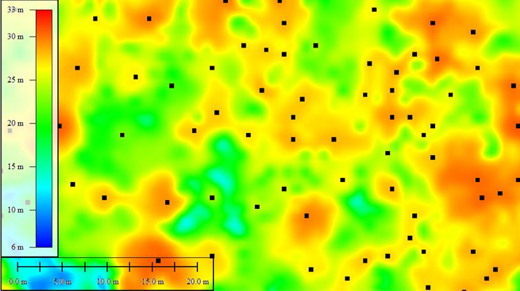
LiDAR-canopy segmentation in Sabangau transect. Small trees (read stars) are missing; black squares correct tree canopies, the area has a 30m x 50m size
Abstract
In south-east Asian peat swamp environments, the natural forest vegetation are known for their rich biodiversity and because they represent important carbon pool. However, the peat swamp forest is decreasing due to its conversion into acacia and oil palm cultivation, excessive draining, forest logging and peat fires. Those peat environments consist of domes regulated by small streams in which 'self-regulation' mechanisms secured permanent water saturation and made the domes exceptionally sensible for climate changes.
Field measurements such as tree height, diameter at breast height (DBH), leaf area index (LAI) and others were conducted through the main transect of the Natural Laboratory of Peat Swamp Forest (NLPSF). This transect is located inside the Sabangau National Park (SNP) in Central Kalimantan (Indonesia). The vegetation was selectively logged in the past up to 1997 and consists of different physiognomies ranging from riverine forest to the tall interior forest towards the peat dome (12km transect).
Airborne Riegl Light Detection And Ranging (LiDAR) LMS-Q560 measurements were acquired from August 6th 2007 and on August 5th 2011. Whereas for the field measurements from Aug. and Sept. 2011.
The aim of this research is to demonstrate how measures derived from LiDAR data can be used to investigate the relationships between canopy height represented (CHM) by the digital surface model (DSM) and the difference to the digital terrain model (DTM) to estimate the above-ground biomass (AGB). Additionally high-resolution Ortho-Photos were used for crown segmentation. Non-linear relationships between the ground measured tree height and DBH were also established for the different physiognomies. Percentiles of both field and CHM were applied in order to test different input parameters for AGB estimation. Allometric equations available in literature for similar forest environments employing DBH and tree height alone and both parameters together were tested too and compared to each other. Similarly we repeat the procedures for the AGB estimation with the CHM and the LiDAR derived DBH. Our results showed that AGB estimation varies considerable according to the allometric equation and its input parameters choice.
By LiDAR change detection method between 2007 and 2011 we found that in this relative undisturbed peat ecosystem the subsistence was in average for 4 years 18cm (SD 4cm) and the tree growth 3.1m (SD 0.75m). This LiDAR-methodology can be used in the frame of the Reducing Emissions from Deforestation and forest Degradation (REDD) knowledge of tropical forests.
Keywords: tropical peat swamp forest, tree height variations, regrowth, peat subsidence, above-ground biomass, LiDAR, CHM
