
remote sensing

our work
kalteng remote sensing shows trends in environments like Kalimantan.
- TanDEM-X elevation model data for canopy height ...
- Monitoring Forest Threats with C- and L-band SAR, ...
- Ground Penetrating Radar Mapping of Peat ...
- Spectral Variability and Discrimination ...
- Kalteng Consultants Company Profile, Oct
- Visiting of Wetlands International Camp on ...
- Ortho Photo Mosaik von Kelurahan Tumbang Tahai ...
- Ortho-Photo Mosaik from Lake Batu, north of ...
- International Symposium & Workshop on Tropical ...
- The Contribution of CHRIS/PROBA Data for Tropical ...
- Workshop on Spatial Planning and new Remote ...
- Ortho-Photo Generation and Mosaiking of City ...
- Ortho-Photo Mosaik from Kecamatan Bukit Batu, ...
- International Workshop, Wild Fire and Carbon ...
- Planning Group for Kecamatan Bukit Batu gathered ...
- Carbon Storage in the Northern Sabangau Area ...
- Peat Land Topography derived from 30m Resolution ...
- Peat depth, minerals below peat, carbon, fires ...
- Carbon Storage in the Northern Sebangau Area ...
- Peatland Topography DEM-measurements with ...
- Precise Measurements of Peatland Topography and ...
- Environmental Management Study of the Tangkiling ...
- Environmental Field Trials and GIS Image ...
- Land Cover Change on Peatland in Kalimantan ...
- The Impact of Logging and Land Use Change in ...
- Tracks along the Kalimantan Highway from Kasongan ...
- Fires in 2002 monitored on the Landsat-images 14 ...
- The Amount of Carbon released from Peat and ...
- Land use Change in Central Kalimantan over the ...
- Remote Sensing and Aerial Survey of Vegetation ...
- Monitoring land cover and impacts, Remote Sensing ...
- Fire Impacts and Carbon Release on Tropical ...
- Ecological Impact of the one Million Hectare Rice ...
- Land Use Change and (Il)-Legal Logging in Central ...
- Peat fires in Central Kalimantan, Indonesia: Fire ...
- Environmental Helicopter Flight Trails with ...
- Impact of the 1997 Fires on the Peatlands of ...
- Application of Remote Sensing and GIS to monitor ...
- Monitoring of 1997/1998 Fires and Burnt Scars in ...
- Flight survey over the Mega Rice Project and over ...
- Application of Remote Sensing and GIS to survey ...
- Mega Rice Project in Central Kalimantan, ...
- Satellite Images and Aerial Photos from the ...
- The need for better
- Remote Sensing Verification by Aerial Surveys and ...
- NATURAL RESOURCE FUNCTIONS, BIODIVERSITY AND ...
- Excursion to Central Kalimantan, ...
- Satellite Images and Aerial Photography’s from ...
- Symposium of International Peat Society, ...
- Indonesia Travel to Jakarta, Bali and Kalimantan ...
- The Mega Rice Project Central Kalimantan ...
- Land Use Planning and Environmental Monitoring in ...
- Bildverarbeitung von Sensorbildern zur Erstellung ...
- GIS-Workshop, Camp km48 Sangai.
- Monitoring Land Use Change on Tropical Peatland ...
- Seminar on Scientific Implications of the ...
- Report of Ground Truth Campaigns incl. Aerial ...
- Ground and Helicopter verification of Satellite ...
- Environmental Detection from Satellite and ...
- First visit to Central Kalimantan in June 1995, ...
- Environmental Helicopter with Modular Sensor ...
- Remote Sensing with a Thermal Imager on an ...
- The Use of an Environmental Helicopter for the ...
- EUROMAR-SEASTARS a Modular Multi-Sensor System ...
gallery

image gallery
Find a large collection of images from many years of exploration by kalteng-consultants.
History Borneo - Kalimantan · Excursions to peatland 1996 · Mega Rice Project 1999 · 2004 · 2005 · 2006 · 2007 · 2008 · 2009 · 2010 · 2011 · 2012 · 2013 · 2014 · 2015 · 2016-March · 2016-August ·
remote sensing
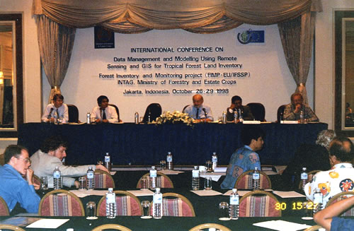
Satellite Images and Aerial Photography’s from the Tropical Peat Swamp Forest in Central Kalimantan, 27. Oct 1998
presented at
International Conference on Data Management and
Modelling Using Remote Sensing and GIS for Tropical Forest Land Inventory,
Jakarta, Oct. 26 - 29, 1998
by
Boehm, H-D.V.
Eurocopter Deutschland GmbH, Kalteng Consultants
81663 München, Germany
Kalteng Consultants
Kirchstockacher Weg 2, Hoehenkirchen, Munich 85635, Germany
Tel: +49-8 I 02-77 4848, fax: +49-8 1 02-7 7 4850
E-mail : viktorboehm@)t-online. de
81663 München, Germany
Kalteng Consultants
Kirchstockacher Weg 2, Hoehenkirchen, Munich 85635, Germany
Tel: +49-8 I 02-77 4848, fax: +49-8 1 02-7 7 4850
E-mail : viktorboehm@)t-online. de
Rainforests are of paramount importance for local climatic processes and probably also for the global climate. Large scale deforestation results in decreasing humidity and rainfall which, in turn, decreases agricultural yields. The reduced evaporation and the accelerated draining of rainwater leads to erosion and to water shortages, not only in regions immediately affected by deforestation. This results in a fundamental difference between deforestation in moderate and tropical climates.
Furthermore rainforests often grow on very poor soils, which allow only 1-3 years farming every 20 years. If these forests are removed either by large scale clear cutting or by uncontrolled forest fires, as happened in 1982/83, 1987, 1994, and 1997 in Kalimantan, it will take centuries until a new forest with a similar species diversity as before will regrow. In moderate climates, in contrast, a forest with similar species composition and diversity as before will regenerate within 10-30 years even after clear felling. In many areas the exploitation and conversion of tropical rain forest proceeds mostly uncontrolled and with increasing rate. The analysis of changing land use patterns has till now mainly depended on optical satellite images and aerial photos. A major disadvantage of optical images for operational planning and monitoring is the frequent cloud coverage in tropical regions, the all-weather-capacity of SAR is a major advantage for land surface monitoring under these conditions.
The overall aim of the Kalteng Consultants research programme is to investigate the evolution and the economic potential of the peat swamp forest (PSF) resource in Central Kalimantan by remote sensing techniques. A multi-spectral and multi-temporal image analysis will evaluate the environmental importance and agricultural potential as well as wildlife conservation aspects.
The paper includes many Satellite images mainly from LANDSAT and ERS and results with signatures from the Feat Swamp Forest type classification in Central Kalimantan. A part of the paper will touch the Mega ha Rice project. Change detection techniques will be presented for Optical and Radar images.
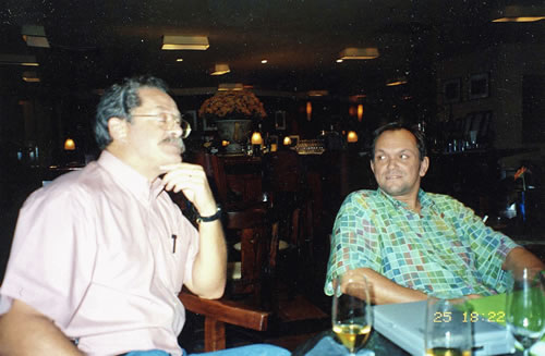
Patrice Levang and Florian Siegert at Mandarin Hotel 25.10.1998
